
By Petr Pridal
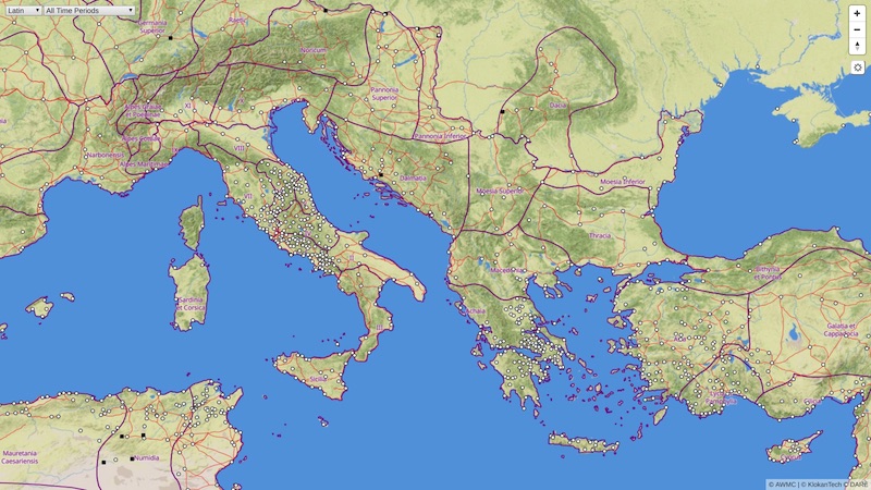
The Roman Empire Vector Map gives people a chance to explore the ancient Mediterranean world as it was during the Roman Empire. They can see much of the road network, discover original place names, and much more with the comfort similar to Google Maps.
A collaborative project of Klokan Technologies and Lund University, supported by a small Pelagios grant, the Roman Empire Vector Map is based on historical data collected by the Pelagios community and the Digital Atlas of the Roman Empire (DARE) project. Project lead Petr Pridal has more of the details.